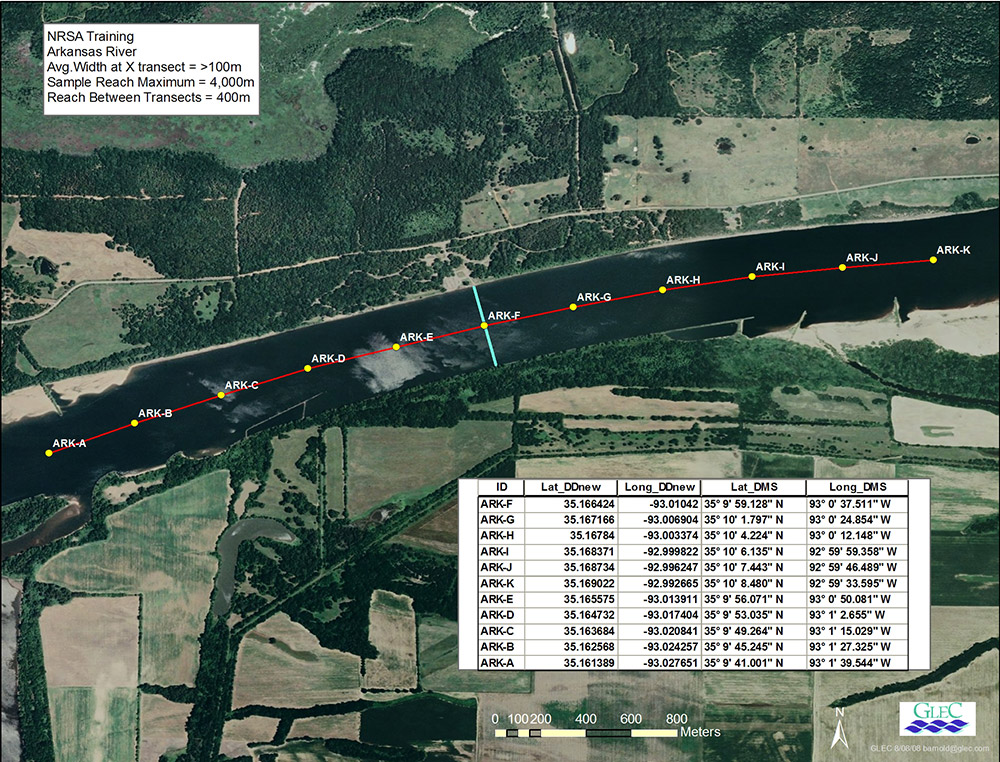
In 2007, EPA initiated the NRSA and in 2008 and 2009 GLEC sampled approximately 565 rivers and streams in the Great Lakes and eastern and southern U.S. GLEC was responsible for field logistics coordination and survey crew training for the NRSA 2013-2014 surveys and led all field survey, training, and logistics for the NRSA 2018-19 and NRSA 2023-24. GLEC and its subcontractors have conducted 2,099 wadeable and non-wadeable river site visits throughout the conterminous U.S for the NRSA. Prior to NRSA survey crew visits, sampling reach maps are created for all non-wadeable river sites using high resolution imagery and GIS applications and a web-based tracking map is employed to enable crews and NRSA program managers to monitor survey progress in near real-time from any device. GLEC’s principal taxonomist led an expert team to identify diatoms in 2,500 NRSA water samples from the NRSA 2008-09; GLEC and subcontractors analyzed and identified approximately 2,500 diatom samples for the NRSA 2018/19 and conducted taxonomic analyses of approximately 2,500 diatom samples for the NRSA 2023/24 as well as mercury in fish tissue plugs collected by field crews.